
US-StJ: St Jones Reserve
- Overview
- Windroses
- Data Citation
- Data Use Log
- Image Gallery
- Remote Sensing Data
- MODIS
- PhenoCam
- GeoNEX
- Publications
- BADM
| Tower_team: | |
| PI: | Rodrigo Vargas rvargasr@asu.edu - Arizona State University |
| Lat, Long: | 39.0882, -75.4372 |
| Elevation(m): | 6.7 |
| Network Affiliations: | AmeriFlux, Phenocam |
| Vegetation IGBP: | WET (Permanent Wetlands: Lands with a permanent mixture of water and herbaceous or woody vegetation that cover extensive areas. The vegetation can be present in either salt, brackish, or fresh water) |
| Climate Koeppen: | Cfa (Humid Subtropical: mild with no dry season, hot summer) |
| Mean Annual Temp (°C): | 13.5 |
| Mean Annual Precip. (mm): | 1121 |
| Flux Species Measured: | CO2, CH4, H, H2O |
| Years Data Collected: | 2015 - Present |
| Years Data Available: | AmeriFlux BASE 2015 - 2020 Data Citation AmeriFlux FLUXNET 2015 - 2020 Data Citation |
| Data Use Policy: | AmeriFlux CC-BY-4.0 Policy1 |
| Description: | |
| URL: | — |
| Research Topics: | Understanding carbon dynamics in a temperate tidal marsh |
| Acknowledgment: | Funding was provided by the National Science Foundation (#1652594) and we acknowledge onsite support from the Delaware National Estuarine Research Reserve (DNERR), |
- This site’s data can also be used under the more restrictive AmeriFlux Legacy Policy.
The AmeriFlux Legacy Policy must be followed if this site’s data are combined with data from sites that require the AmeriFlux Legacy Policy.
Copyright preference: Request for permission
US-StJ: St Jones Reserve
- Overview
- Windroses
- Data Citation
- Data Use Log
- Image Gallery
- Remote Sensing Data
- MODIS
- PhenoCam
- GeoNEX
- Publications
- BADM
Use the information below for citation of this site. See the Data Policy page for more details.
DOI(s) for citing US-StJ data
Data Use Policy: AmeriFlux CC-BY-4.0 License
This site’s data can also be used under the more restrictive AmeriFlux Legacy Policy.
The AmeriFlux Legacy Policy must be followed if US-StJ data are combined with data from sites that require the AmeriFlux Legacy Policy.
- AmeriFlux BASE: https://doi.org/10.17190/AMF/1480316
Citation: Rodrigo Vargas (2026), AmeriFlux BASE US-StJ St Jones Reserve, Ver. 3-5, AmeriFlux AMP, (Dataset). https://doi.org/10.17190/AMF/1480316 - AmeriFlux FLUXNET: https://doi.org/10.17190/AMF/2229390
Citation: Rodrigo Vargas (2026), AmeriFlux FLUXNET-1F US-StJ St Jones Reserve, Ver. v1.3_r1, AmeriFlux AMP, (Dataset). https://doi.org/10.17190/AMF/2229390
Find global FLUXNET datasets, like FLUXNET2015 and FLUXNET-CH4, and their citation information at fluxnet.org.
To cite BADM when downloaded on their own, use the publications below for citing site characterization. When using BADM that are downloaded with AmeriFlux BASE and AmeriFlux FLUXNET products, use the DOI citation for the associated data product.
Publication(s) for citing site characterization
- —
Acknowledgments
- —
Resources
- AmeriFlux Logos & Acknowledgments
US-StJ: St Jones Reserve
- Overview
- Windroses
- Data Citation
- Data Use Log
- Image Gallery
- Remote Sensing Data
- MODIS
- PhenoCam
- GeoNEX
- Publications
- BADM

This page displays the list of downloads of data for the site {{siteId}}.
Note: Results are the number of downloads to distinct data users. The Download Count column indicates the number of times the data user downloaded the data. The Version column refers to the version of the data product for the site that was downloaded by the data user.
| Date | Name | Data Product | Vers. | Intended Use | Intended Use Description | Download Count |
|---|---|---|---|---|---|---|
| {{dlObject.timeStamp}} | {{dlObject.displayName}} | {{displayProduct(dlObject.dataProduct)}} | {{dlObject.version}} | {{dlObject.intendedUse}} | {{dlObject.comment}} | {{dlObject.downloadCounter}} |
Showing {{startItem + 1}} to {{(startItem + items) > filtered.length ? filtered.length : (startItem + items)}} of {{filtered.length}} results
Showing 0 to 0 of 0 results
Not Found
Uh Oh. Something is missing. Try double checking the URL and try again.
US-StJ: St Jones Reserve
- Overview
- Windroses
- Data Citation
- Data Use Log
- Image Gallery
- Remote Sensing Data
- MODIS
- PhenoCam
- GeoNEX
- Publications
- BADM
| AmeriFlux Images | Add Image |
 US-StJ
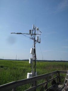
 2015.US.StJ.Sitevisit.IMG_6312
2015.US.StJ.Sitevisit.IMG_6312
Keywords: —
Location:
View in Original Size
To download, right-click photo (Mac: control-click) and choose Save Image As
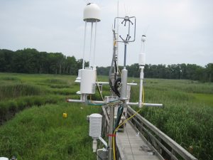
US-StJ 2015.US.StJ.Sitevisit.IMG_6327
2015.US.StJ.Sitevisit.IMG_6327
Keywords: —
Location:
View in Original Size
To download, right-click photo (Mac: control-click) and choose Save Image As
US-StJ: St Jones Reserve
- Overview
- Windroses
- Data Citation
- Data Use Log
- Image Gallery
- Remote Sensing Data
- MODIS
- PhenoCam
- GeoNEX
- Publications
- BADM
MODIS NDVI
The time series shows the 16-day Normalized Difference Vegetation Index (NDVI) average from the MOD13Q1 data product.
Use the slider below the time series to zoom in and out.
To view / download these data and other MOD13Q1 products for this site, visit MODIS/Terra Vegetation Indices.
For other related products, visit MODIS/VIIRS Fixed Sites Subsets Tool.
Citation:
ORNL DAAC. 2018. Terrestrial Ecology Subsetting & Visualization Services (TESViS) Fixed Sites Subsets. ORNL DAAC, Oak Ridge, Tennessee, USA. https://doi.org/10.3334/ORNLDAAC/1567
MODIS NDVI subsetted data is not yet available for this site.
For a complete list of AmeriFlux sites, visit ORNL DAAC's MODIS/VIIRS Fixed Sites Subsets Tool.


US-StJ: St Jones Reserve
- Overview
- Windroses
- Data Citation
- Data Use Log
- Image Gallery
- Remote Sensing Data
- MODIS
- PhenoCam
- GeoNEX
- Publications
- BADM
| AmeriFlux Publications | Add Publication |
| Year | Publication |
|---|---|
| 2024 | Capooci M, Seyfferth AL, Tobias CHigh methane concentrations in tidal salt marsh soils: Where does the methane go?, Wozniak AS, Hedgpeth A, Bowen M, Biddle JF, McFarlane KJ, Vargas R (2024) High methane concentrations in tidal salt marsh soils: Where does the methane go?, Global Change Biology, 30(1), e17050. https://doi.org/10.1111/gcb.17050 |
| 2024 | Andrew Hill, Inke Forbich, Karina Schafer, Rodrigo Vargas (2024) Empirical dynamic modeling reveals complexity of methane fluxes in a temperate salt marsh, JGR-Biogeosciences, 129(2), e2023JG007630. https://doi.org/10.1029/2023JG007630 |
| 2023 | Alma Vazquez-Lule, Rodrigo Vargas (2023) Proximal remote sensing and gross primary productivity in a temperate salt marsh, Agricultural and Forest Meteorology, 341, 109639. https://doi.org/10.1016/j.agrformet.2023.109639 |
| 2024 | (2024) A New Coupled Biogeochemical Modeling Approach Provides Accurate Predictions of Methane and Carbon Dioxide Fluxes Across Diverse Tidal Wetlands, Journal of Geophysical Research - Biogeosciences, . https://doi.org/10.1029/2023JG007943 |
| 2022 | Capooci, M., Vargas, R. (2022) Diel And Seasonal Patterns Of Soil Co2 Efflux In A Temperate Tidal Marsh, Science Of The Total Environment, 802, 149715. https://doi.org/10.1016/j.scitotenv.2021.149715 |
| 2022 | Hill, A. C., Vargas, R. (2022) Methane And Carbon Dioxide Fluxes In A Temperate Tidal Salt Marsh: Comparisons Between Plot And Ecosystem Measurements, Journal Of Geophysical Research: Biogeosciences, 127(7), . https://doi.org/10.1029/2022JG006943 |
| 2022 | Capooci, M., Vargas, R. (2022) Trace Gas Fluxes From Tidal Salt Marsh Soils: Implications For Carbon–Sulfur Biogeochemistry, Biogeosciences, 19(19), 4655-4670. https://doi.org/10.5194/bg-19-4655-2022 |
| 2021 | Hill, A. C., Vázquez-Lule, A., Vargas, R. (2021) Linking Vegetation Spectral Reflectance With Ecosystem Carbon Phenology In A Temperate Salt Marsh, Agricultural And Forest Meteorology, 307, 108481. https://doi.org/10.1016/j.agrformet.2021.108481 |
| 2021 | Vázquez-Lule, A., Vargas, R. (2021) Biophysical Drivers Of Net Ecosystem And Methane Exchange Across Phenological Phases In A Tidal Salt Marsh, Agricultural And Forest Meteorology, 300, 108309. https://doi.org/10.1016/j.agrformet.2020.108309 |
| 2021 | Chu, H., Luo, X., Ouyang, Z., Chan, W. S., Dengel, S., Biraud, S. C., Torn, M. S., Metzger, S., Kumar, J., Arain, M. A., Arkebauer, T. J., Baldocchi, D., Bernacchi, C., Billesbach, D., Black, T. A., Blanken, P. D., Bohrer, G., Bracho, R., Brown, S., Brunsell, N. A., Chen, J., Chen, X., Clark, K., Desai, A. R., Duman, T., Durden, D., Fares, S., Forbrich, I., Gamon, J. A., Gough, C. M., Griffis, T., Helbig, M., Hollinger, D., Humphreys, E., Ikawa, H., Iwata, H., Ju, Y., Knowles, J. F., Knox, S. H., Kobayashi, H., Kolb, T., Law, B., Lee, X., Litvak, M., Liu, H., Munger, J. W., Noormets, A., Novick, K., Oberbauer, S. F., Oechel, W., Oikawa, P., Papuga, S. A., Pendall, E., Prajapati, P., Prueger, J., Quinton, W. L., Richardson, A. D., Russell, E. S., Scott, R. L., Starr, G., Staebler, R., Stoy, P. C., Stuart-Haëntjens, E., Sonnentag, O., Sullivan, R. C., Suyker, A., Ueyama, M., Vargas, R., Wood, J. D., Zona, D. (2021) Representativeness Of Eddy-Covariance Flux Footprints For Areas Surrounding Ameriflux Sites, Agricultural And Forest Meteorology, 301-302, 108350. https://doi.org/10.1016/j.agrformet.2021.108350 |
| 2020 | Trifunovic, B., Vázquez‐Lule, A., Capooci, M., Seyfferth, A. L., Moffat, C., Vargas, R. (2020) Carbon Dioxide And Methane Emissions From A Temperate Salt Marsh Tidal Creek, Journal Of Geophysical Research: Biogeosciences, 125(8), . https://doi.org/10.1029/2019JG005558 |
| 2019 | Capooci, M., Barba, J., Seyfferth, A. L., Vargas, R. (2019) Experimental Influence Of Storm-Surge Salinity On Soil Greenhouse Gas Emissions From A Tidal Salt Marsh, Science Of The Total Environment, 686, 1164-1172. https://doi.org/10.1016/j.scitotenv.2019.06.032 |
| 2020 | Feagin, R. A., Forbrich, I., Huff, T. P., Barr, J. G., Ruiz‐Plancarte, J., Fuentes, J. D., Najjar, R. G., Vargas, R., Vázquez‐Lule, A., Windham‐Myers, L., Kroeger, K. D., Ward, E. J., Moore, G. W., Leclerc, M., Krauss, K. W., Stagg, C. L., Alber, M., Knox, S. H., Schäfer, K. V., Bianchi, T. S., Hutchings, J. A., Nahrawi, H., Noormets, A., Mitra, B., Jaimes, A., Hinson, A. L., Bergamaschi, B., King, J. S., Miao, G. (2020) Tidal Wetland Gross Primary Production Across The Continental United States, 2000–2019, Global Biogeochemical Cycles, 34(2), . https://doi.org/10.1029/2019GB006349 |
US-StJ: St Jones Reserve
- Overview
- Windroses
- Data Citation
- Data Use Log
- Image Gallery
- Remote Sensing Data
- MODIS
- PhenoCam
- GeoNEX
- Publications
- BADM
BADM for This Site
Access the Biological, Ancillary, Disturbance and Metadata (BADM) information and data for this site.
BADM contain information for many uses, such as characterizing a site’s vegetation and soil, describing disturbance history, and defining instrumentation for flux processing. They complement the flux/met data.
- Download BADM for this site*
- View Site General Info for this site (Overview tab)*
- Use Online Editor to update Site General Info or DOI Authorship
- Update information about submitted data (Variable Information tool)
- More BADM resources
* Online updates are shown on the Overview tab real time. However, downloaded BADM files will not reflect those updates until they have been reviewed for QA/QC.
US-StJ: St Jones Reserve
- Overview
- Windroses
- Data Citation
- Data Use Log
- Image Gallery
- Remote Sensing Data
- MODIS
- PhenoCam
- GeoNEX
- Publications
- BADM
Wind Roses
Wind Speed (m/s)
- Wind Speed Scale: Per Site
- Wind Direction Scale (%): Per Site
- Wind Speed Scale: Non-Linear
- Wind Direction Scale (%): AmeriFlux