
US-Snd: Sherman Island
- Overview
- Windroses
- Data Citation
- Data Use Log
- Image Gallery
- Remote Sensing Data
- MODIS
- PhenoCam
- GeoNEX
- Publications
- BADM
| Tower_team: | |
| PI: | Dennis Baldocchi Baldocchi@berkeley.edu - University of California, Berkeley |
| AncContact: | Daphne Szutu daphneszutu@berkeley.edu - UC Berkeley |
| AncContact: | Joe Verfaillie jverfail@berkeley.edu - University of California, Berkeley |
| FluxContact: | Patty Oikwawa patty.oikawa@csueastbay.edu - Cal State East Bay, Hayward, CA |
| Lat, Long: | 38.0366, -121.7540 |
| Elevation(m): | -5 |
| Network Affiliations: | AmeriFlux, Phenocam |
| Vegetation IGBP: | GRA (Grasslands: Lands with herbaceous types of cover. Tree and shrub cover is less than 10%. Permanent wetlands lands with a permanent mixture of water and herbaceous or woody vegetation. The vegetation can be present in either salt, brackish, or fresh water.) |
| Climate Koeppen: | Csa (Mediterranean: mild with dry, hot summer) |
| Mean Annual Temp (°C): | 15.6 |
| Mean Annual Precip. (mm): | 358 |
| Flux Species Measured: | CO2, H2O, CH4 |
| Years Data Collected: | 2007 - 2015 |
| Years Data Available: | AmeriFlux BASE 2007 - 2014 Data Citation |
| Data Use Policy: | AmeriFlux CC-BY-4.0 Policy1 |
| Description: | |
| URL: | http://nature.berkeley.edu/biometlab/sites.php?tab=US-Snd |
| Research Topics: | |
| Acknowledgment: | Biometeorology Lab, University of California, Berkeley, PI: Dennis Baldocchi |
- This site’s data can also be used under the more restrictive AmeriFlux Legacy Policy.
The AmeriFlux Legacy Policy must be followed if this site’s data are combined with data from sites that require the AmeriFlux Legacy Policy.
Copyright preference: Request for permission
US-Snd: Sherman Island
- Overview
- Windroses
- Data Citation
- Data Use Log
- Image Gallery
- Remote Sensing Data
- MODIS
- PhenoCam
- GeoNEX
- Publications
- BADM
Use the information below for citation of this site. See the Data Policy page for more details.
DOI(s) for citing US-Snd data
Data Use Policy: AmeriFlux CC-BY-4.0 License
This site’s data can also be used under the more restrictive AmeriFlux Legacy Policy.
The AmeriFlux Legacy Policy must be followed if US-Snd data are combined with data from sites that require the AmeriFlux Legacy Policy.
- AmeriFlux BASE: https://doi.org/10.17190/AMF/1246094
Citation: Matteo Detto, Cove Sturtevant, Patty Oikawa, Joseph Verfaillie, Dennis Baldocchi (2016), AmeriFlux BASE US-Snd Sherman Island, Ver. 2-1, AmeriFlux AMP, (Dataset). https://doi.org/10.17190/AMF/1246094
To cite BADM when downloaded on their own, use the publications below for citing site characterization. When using BADM that are downloaded with AmeriFlux BASE and AmeriFlux FLUXNET products, use the DOI citation for the associated data product.
Publication(s) for citing site characterization
- —
Acknowledgments
- —
Resources
- AmeriFlux Logos & Acknowledgments
US-Snd: Sherman Island
- Overview
- Windroses
- Data Citation
- Data Use Log
- Image Gallery
- Remote Sensing Data
- MODIS
- PhenoCam
- GeoNEX
- Publications
- BADM

This page displays the list of downloads of data for the site {{siteId}}.
Note: Results are the number of downloads to distinct data users. The Download Count column indicates the number of times the data user downloaded the data. The Version column refers to the version of the data product for the site that was downloaded by the data user.
| Date | Name | Data Product | Vers. | Intended Use | Intended Use Description | Download Count |
|---|---|---|---|---|---|---|
| {{dlObject.timeStamp}} | {{dlObject.displayName}} | {{displayProduct(dlObject.dataProduct)}} | {{dlObject.version}} | {{dlObject.intendedUse}} | {{dlObject.comment}} | {{dlObject.downloadCounter}} |
Showing {{startItem + 1}} to {{(startItem + items) > filtered.length ? filtered.length : (startItem + items)}} of {{filtered.length}} results
Showing 0 to 0 of 0 results
Not Found
Uh Oh. Something is missing. Try double checking the URL and try again.
US-Snd: Sherman Island
- Overview
- Windroses
- Data Citation
- Data Use Log
- Image Gallery
- Remote Sensing Data
- MODIS
- PhenoCam
- GeoNEX
- Publications
- BADM
| AmeriFlux Images | Add Image |
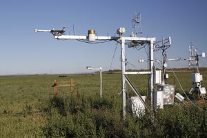
US-Snd 2013.US.Snd.sitevisit20130418__MG_3195
2013.US.Snd.sitevisit20130418__MG_3195
Keywords: —
Location:
View in Original Size
To download, right-click photo (Mac: control-click) and choose Save Image As
 US-Snd
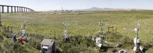
 2013.US.Snd.sitevisitPanorama 1
2013.US.Snd.sitevisitPanorama 1
Keywords: —
Location: United States
View in Original Size
To download, right-click photo (Mac: control-click) and choose Save Image As
 US-Snd
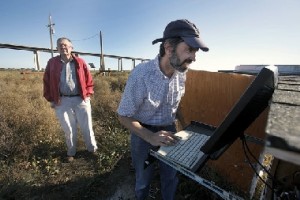
 Dennis Baldocchi viewing flux data at his AmeriFlux Site at Sherman Island, CA.
Keywords: —
Location: California, United States
View in Original Size
To download, right-click photo (Mac: control-click) and choose Save Image As
 US-Snd
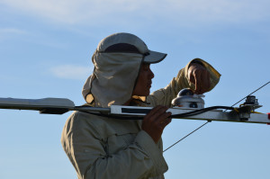
 AMP Tech Team’s Stephen Chan cleaning radiation sensor during QA/QC site visit, Sherman Island, SF Bay Area Delta, CA.
Keywords: —
Location: California,
View in Original Size
To download, right-click photo (Mac: control-click) and choose Save Image As
US-Snd: Sherman Island
- Overview
- Windroses
- Data Citation
- Data Use Log
- Image Gallery
- Remote Sensing Data
- MODIS
- PhenoCam
- GeoNEX
- Publications
- BADM
MODIS NDVI
The time series shows the 16-day Normalized Difference Vegetation Index (NDVI) average from the MOD13Q1 data product.
Use the slider below the time series to zoom in and out.
To view / download these data and other MOD13Q1 products for this site, visit MODIS/Terra Vegetation Indices.
For other related products, visit MODIS/VIIRS Fixed Sites Subsets Tool.
Citation:
ORNL DAAC. 2018. Terrestrial Ecology Subsetting & Visualization Services (TESViS) Fixed Sites Subsets. ORNL DAAC, Oak Ridge, Tennessee, USA. https://doi.org/10.3334/ORNLDAAC/1567
MODIS NDVI subsetted data is not yet available for this site.
For a complete list of AmeriFlux sites, visit ORNL DAAC's MODIS/VIIRS Fixed Sites Subsets Tool.


US-Snd: Sherman Island
- Overview
- Windroses
- Data Citation
- Data Use Log
- Image Gallery
- Remote Sensing Data
- MODIS
- PhenoCam
- GeoNEX
- Publications
- BADM
| AmeriFlux Publications | Add Publication |
| Year | Publication |
|---|---|
| 2025 | Xia, Y., Sanderman, J., Watts, J. D., Machmuller, M. B., Mullen, A. L., Rivard, C., Endsley, A., Hernandez, H., Kimball, J., Ewing, S. A., Litvak, M., Duman, T., Krishnan, P., Meyers, T., Brunsell, N. A., Mohanty, B., Liu, H., Gao, Z., Chen, J., Abraha, M., Scott, R. L., Flerchinger, G. N., Clark, P. E., Stoy, P. C., Khan, A. M., Brookshire, E. N., Zhang, Q., Cook, D. R., Thienelt, T., Mitra, B., Mauritz‐Tozer, M., Tweedie, C. E., Torn, M. S., Billesbach, D. (2025) Coupling Remote Sensing With A Process Model For The Simulation Of Rangeland Carbon Dynamics, Journal Of Advances In Modeling Earth Systems, 17(3), . https://doi.org/10.1029/2024MS004342 |
| 2021 | Chu, H., Luo, X., Ouyang, Z., Chan, W. S., Dengel, S., Biraud, S. C., Torn, M. S., Metzger, S., Kumar, J., Arain, M. A., Arkebauer, T. J., Baldocchi, D., Bernacchi, C., Billesbach, D., Black, T. A., Blanken, P. D., Bohrer, G., Bracho, R., Brown, S., Brunsell, N. A., Chen, J., Chen, X., Clark, K., Desai, A. R., Duman, T., Durden, D., Fares, S., Forbrich, I., Gamon, J. A., Gough, C. M., Griffis, T., Helbig, M., Hollinger, D., Humphreys, E., Ikawa, H., Iwata, H., Ju, Y., Knowles, J. F., Knox, S. H., Kobayashi, H., Kolb, T., Law, B., Lee, X., Litvak, M., Liu, H., Munger, J. W., Noormets, A., Novick, K., Oberbauer, S. F., Oechel, W., Oikawa, P., Papuga, S. A., Pendall, E., Prajapati, P., Prueger, J., Quinton, W. L., Richardson, A. D., Russell, E. S., Scott, R. L., Starr, G., Staebler, R., Stoy, P. C., Stuart-Haëntjens, E., Sonnentag, O., Sullivan, R. C., Suyker, A., Ueyama, M., Vargas, R., Wood, J. D., Zona, D. (2021) Representativeness Of Eddy-Covariance Flux Footprints For Areas Surrounding Ameriflux Sites, Agricultural And Forest Meteorology, 301-302, 108350. https://doi.org/10.1016/j.agrformet.2021.108350 |
| 2019 | Hemes, K. S., Chamberlain, S. D., Eichelmann, E., Anthony, T., Valach, A., Kasak, K., Szutu, D., Verfaillie, J., Silver, W. L., Baldocchi, D. D. (2019) Assessing The Carbon And Climate Benefit Of Restoring Degraded Agricultural Peat Soils To Managed Wetlands, Agricultural And Forest Meteorology, 268, 202-214. https://doi.org/10.1016/j.agrformet.2019.01.017 |
| 2018 | Baldocchi, D., Penuelas, J. (2018) The Physics And Ecology Of Mining Carbon Dioxide From The Atmosphere By Ecosystems, Global Change Biology, . https://doi.org/10.1111/gcb.14559 |
| 2018 | Eichelmann, E., Hemes, K. S., Knox, S. H., Oikawa, P. Y., Chamberlain, S. D., Sturtevant, C., Verfaillie, J., Baldocchi, D. D. (2018) The Effect Of Land Cover Type And Structure On Evapotranspiration From Agricultural And Wetland Sites In The Sacramento–San Joaquin River Delta, California, Agricultural And Forest Meteorology, 256-257, 179-195. https://doi.org/10.1016/j.agrformet.2018.03.007 |
| 2017 | Chamberlain, S. D., Verfaillie, J., Eichelmann, E., Hemes, K. S., Baldocchi, D. D. (2017) Evaluation Of Density Corrections To Methane Fluxes Measured By Open-Path Eddy Covariance Over Contrasting Landscapes, Boundary-Layer Meteorology, . https://doi.org/10.1007/s10546-017-0275-9 |
| 2011 | Sonnentag, O., Detto, M., Runkle, B. R. K., Teh, Y. A., Silver, W. L., Kelly, M., Baldocchi, D. D. (2011) Carbon Dioxide Exchange Of A Pepperweed ( Lepidium Latifolium L.) Infestation: How Do Flowering And Mowing Affect Canopy Photosynthesis And Autotrophic Respiration?, Journal Of Geophysical Research, 116(G1), n/a-n/a. https://doi.org/10.1029/2010jg001522 |
| 2011 | Sonnentag, O., Detto, M., Vargas, R., Ryu, Y., Runkle, B., Kelly, M., Baldocchi, D. (2011) Tracking The Structural And Functional Development Of A Perennial Pepperweed (Lepidium Latifolium L.) Infestation Using A Multi-Year Archive Of Webcam Imagery And Eddy Covariance Measurements, Agricultural And Forest Meteorology, 151(7), 916-926. https://doi.org/10.1016/j.agrformet.2011.02.011 |
| 2011 | Detto, M., Verfaillie, J., Anderson, F., Xu, L., Baldocchi, D. (2011) Comparing Laser-Based Open- And Closed-Path Gas Analyzers To Measure Methane Fluxes Using The Eddy Covariance Method, Agricultural And Forest Meteorology, 151(10), 1312-1324. https://doi.org/10.1016/j.agrformet.2011.05.014 |
| 2011 | Teh, Y. A., Silver, W. L., Sonnentag, O., Detto, M., Kelly, M., Baldocchi, D. D. (2011) Large Greenhouse Gas Emissions From A Temperate Peatland Pasture, Ecosystems, 14(2), 311-325. https://doi.org/10.1007/s10021-011-9411-4 |
| 2012 | Hatala, J. A., Detto, M., Sonnentag, O., Deverel, S. J., Verfaillie, J., Baldocchi, D. D. (2012) Greenhouse Gas (CO2, CH4, H2O) Fluxes From Drained And Flooded Agricultural Peatlands In The Sacramento-San Joaquin Delta, Agriculture, Ecosystems & Environment, 150, 1-18. https://doi.org/10.1016/j.agee.2012.01.009 |
| 2012 | Baldocchi, D., Detto, M., Sonnentag, O., Verfaillie, J., Teh, Y. A., Silver, W., Kelly, N. M. (2012) The Challenges Of Measuring Methane Fluxes And Concentrations Over A Peatland Pasture, Agricultural And Forest Meteorology, 153, 177-187. https://doi.org/10.1016/j.agrformet.2011.04.013 |
| 2010 | Detto, M., Baldocchi, D., Katul, G. G. (2010) Scaling Properties Of Biologically Active Scalar Concentration Fluctuations In The Atmospheric Surface Layer Over A Managed Peatland, Boundary-Layer Meteorology, 136(3), 407-430. https://doi.org/10.1007/s10546-010-9514-z |
| 2012 | Ma, S., Baldocchi, D. D., Hatala, J. A., Detto, M., Curiel Yuste, J. (2012) Are Rain-Induced Ecosystem Respiration Pulses Enhanced By Legacies Of Antecedent Photodegradation In Semi-Arid Environments?, Agricultural And Forest Meteorology, 154-155, 203-213. https://doi.org/10.1016/j.agrformet.2011.11.007 |
| 2014 | Knox, S. H.,, Sturtevant, C., Matthes, J.H., Koteen, L., Verfaillie,J., Baldocchi. D. (2014) Agricultural peatland restoration: effects of land-use change on greenhouse gas (CO2 and CH4) fluxes in the Sacramento-San Joaquin Delta, Global Change Biology, 21, 750-765. https://doi.org/10.1111/gcb.12745 |
US-Snd: Sherman Island
- Overview
- Windroses
- Data Citation
- Data Use Log
- Image Gallery
- Remote Sensing Data
- MODIS
- PhenoCam
- GeoNEX
- Publications
- BADM
BADM for This Site
Access the Biological, Ancillary, Disturbance and Metadata (BADM) information and data for this site.
BADM contain information for many uses, such as characterizing a site’s vegetation and soil, describing disturbance history, and defining instrumentation for flux processing. They complement the flux/met data.
- Download BADM for this site*
- View Site General Info for this site (Overview tab)*
- Use Online Editor to update Site General Info or DOI Authorship
- Update information about submitted data (Variable Information tool)
- More BADM resources
* Online updates are shown on the Overview tab real time. However, downloaded BADM files will not reflect those updates until they have been reviewed for QA/QC.
US-Snd: Sherman Island
- Overview
- Windroses
- Data Citation
- Data Use Log
- Image Gallery
- Remote Sensing Data
- MODIS
- PhenoCam
- GeoNEX
- Publications
- BADM
Wind Roses
Wind Speed (m/s)
- Wind Speed Scale: Per Site
- Wind Direction Scale (%): Per Site
- Wind Speed Scale: Non-Linear
- Wind Direction Scale (%): AmeriFlux