Dear community,
We’re thrilled to announce a new feature on the AmeriFlux website: NASA GeoNEX data products are now available, providing cutting-edge Earth monitoring datasets to enhance your research and insights.
What is GeoNEX?
GeoNEX led by NASA Earth eXchange (NEX) is a collaborative effort for generating Earth monitoring products from the new generation of geostationary satellite sensors. GeoNEX has produced a suite of geostationary data products including surface reflectance, land surface temperature, surface solar radiation, and many others.
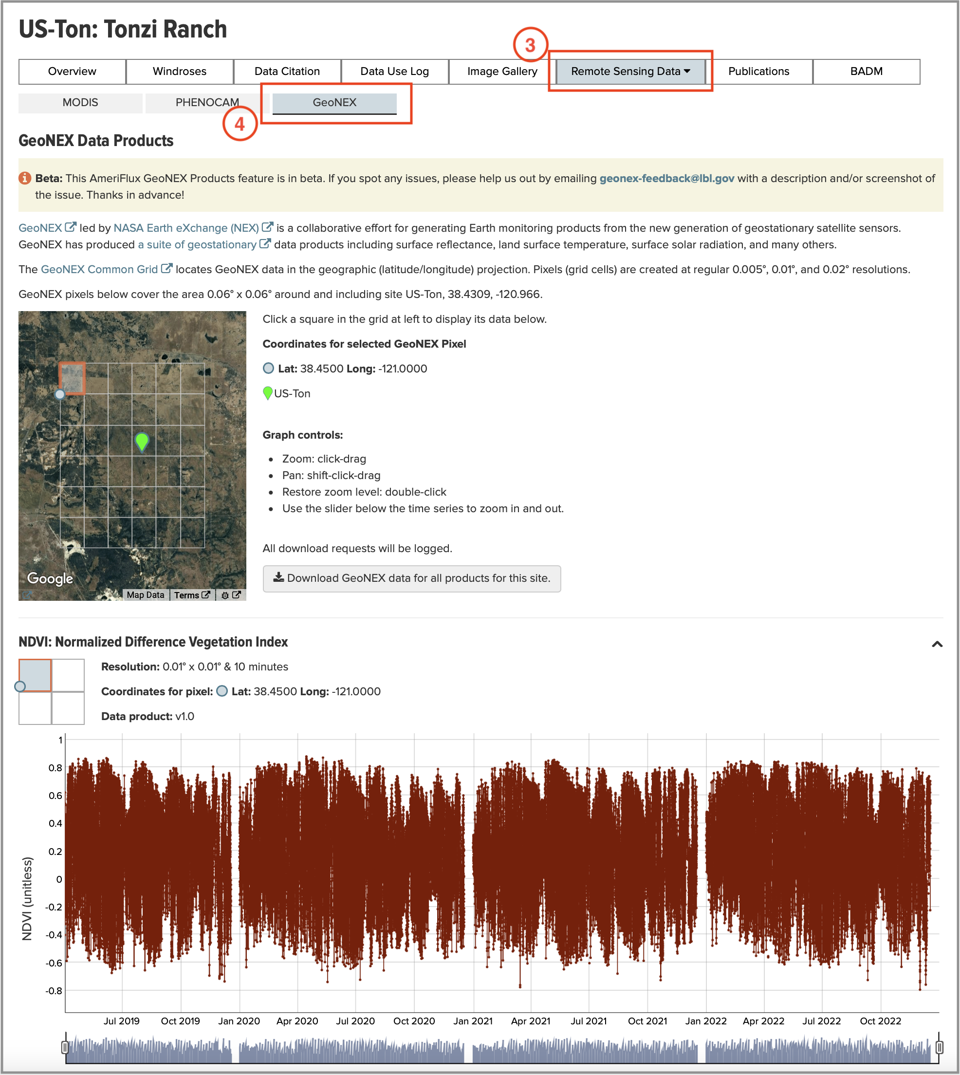
The newly launched GeoNEX page offers sub-hourly datasets for key environmental parameters, including vegetation indices (NDVI and NIRv), surface downward shortwave radiation, and land surface temperature. The data will be updated regularly, and more products from GeoNEX will become available soon.
These datasets provide unparalleled temporal resolution for AmeriFlux sites, enabling researchers to analyze fine-scale dynamics in ecosystem processes like never before.
Try these samples sites:
- CA-BOU: Bouleau Peatland
https://ameriflux.lbl.gov/sites/siteinfo/CA-BOU#related.geonex
- MX-PMm: Puerto Morelos mangrove
https://ameriflux.lbl.gov/sites/siteinfo/MX-PMm#related.geonex
- PR-xGU: NEON Guanica Forest (GUAN)
https://ameriflux.lbl.gov/sites/siteinfo/PR-xGU#related.geonex
Visiting a GeoNEX page for a specific site
Follow the steps below to visit the new GeoNEX page on the AmeriFlux website today and start exploring these datasets!
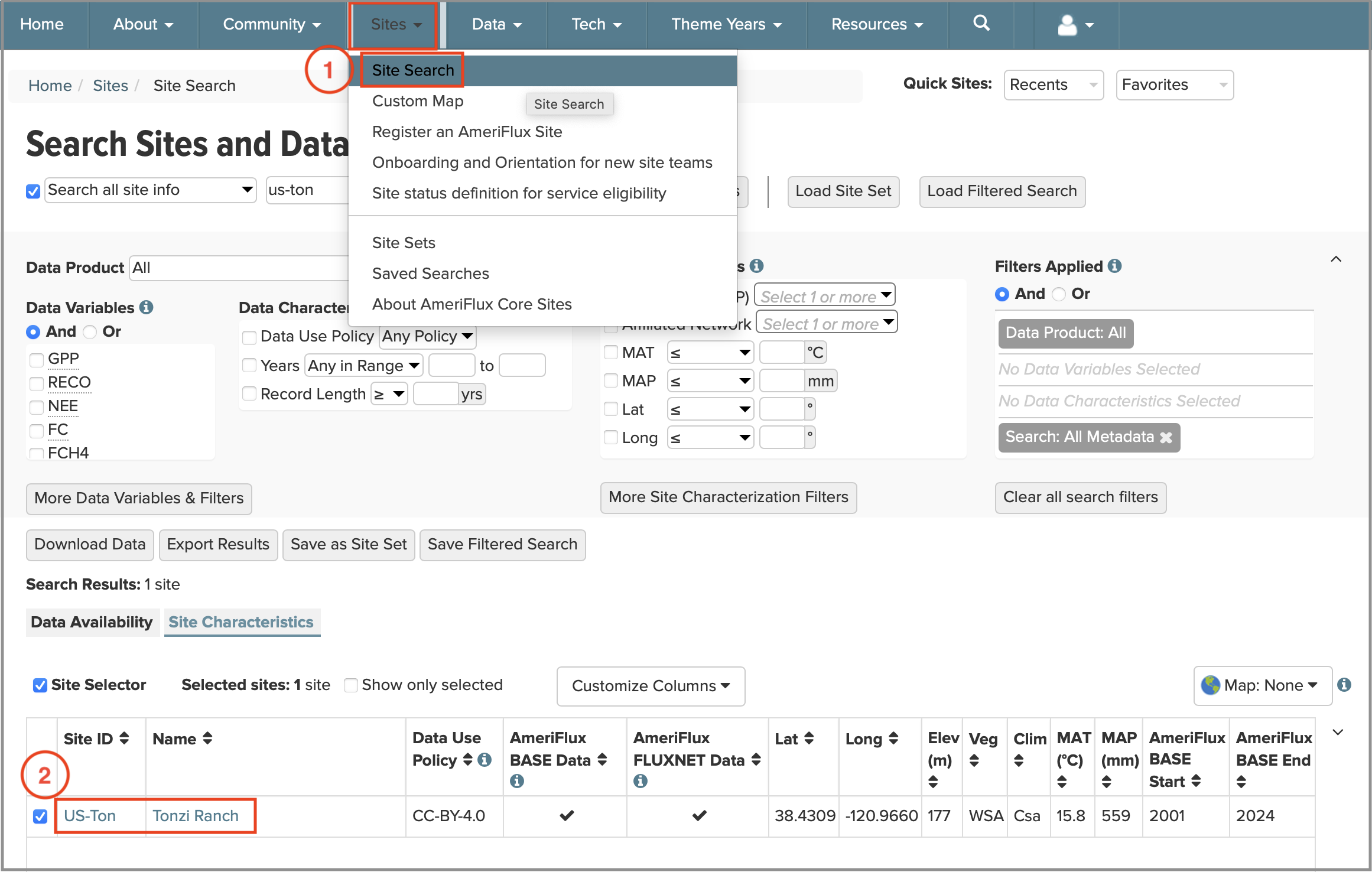
1. Visit the Site search page under Sites tab and select an AmeriFlux site (Figure 1).
2. At the Site info page, click Remote Sensing Data tab and then select GeoNEX tab (Figure 2).
The AmeriFlux GeoNEX feature is currently in beta. We welcome your feedback to ensure the highest quality experience. Please report any issues to geonex-feedback@lbl.gov with a description or screenshot. Your input is invaluable—thank you for helping us improve!
AmeriFlux Management Project


No Comments
Be the first to start a conversation